Singapore - Location, size, and extent
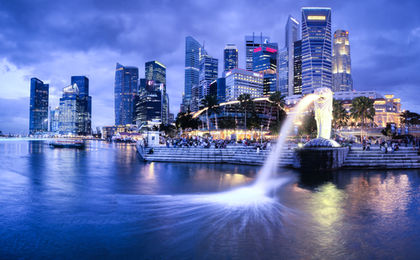
The Republic of Singapore, the second smallest country in Asia, consists of Singapore Island and several smaller adjacent islets. Situated in the Indian Ocean off the southern tip of the Malay Peninsula, Singapore has an area of 693 sq km (268 sq mi). Comparatively, the area occupied by Singapore is slightly more than 3.5 times the size of Washington, D.C. Singapore Island extends 41.8 km (26 mi) ENE – WSW and 22.5 km (14 mi) SSE – NNW and has a coastline of 193 km (120 mi), including about 84 km (52 mi) along the water channel between the island and the Malay Peninsula. Singapore is connected to the nearby western portion of Malaysia by a causeway 1,056 m (3,465 ft) in length across the narrow Johore Strait. Singapore's position at the eastern end of the Strait of Malacca, which separates western Malaysia and the Indonesian island of Sumatra, has given it economic and strategic importance out of proportion to its small size. Singapore's capital city, Singapore, is located on the country's southern coast.
I never realised how small the country was until I was playing with google maps.
I had always thought that it was around the size of its cousins, wasn't I mistaken !
-Roger Doger Rogerson
I never realised how small the country was until I was playing with google maps.
I had always thought that it was around the size of its cousins, wasn't I mistaken !
Read more: Location, size, and extent - Singapore - located, area http://www.nationsencyclopedia.com/Asia-and-Oceania/Singapore-LOCATION-SIZE-AND-EXTENT.html#ixzz0d4iMdWMA