Myanmar - Transportation
Because of Myanmar's near encirclement by mountain ranges, international land transportation is virtually nonexistent. Historically, Myanmar has been dependent on sea and river transport externally and internally, supplemented in modern times by the airplane. The Myanmar Road, connecting Lashio with Kunming in southern China, and the Ledo Road between Myitkyina and Ledo in Assam, northeastern India, are the only land ties between Myanmar and adjacent nations. There were an estimated 28,200 km (17,523 mi) of roads in 2002, but only 3,440 km (2,138 mi) were paved. In 2000, Myanmar had about 73,900 passenger cars and 49,300 commercial vehicles.
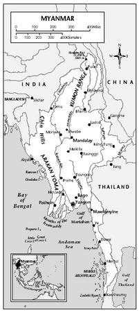
Myanmar's railway system, a government monopoly, operates 3,991 km (2,480 mi) of track, all of which is meter-gauge in 2002. The main lines are from Yangon (Rangoon) to Prome (259 km/161 mi) and from Yangon to Mandalay (621 km/386 mi) and then to Myitkyina (1,164 km/723 mi from the capital).
Inland waterways, including some 12,800 km (7,954 mi) of navigable passages (25% of which are navigable by commercial vessels), are the key to internal transportation, partly compensating for limited railroad and highway development.
Some 500,000 small river craft ply the Irrawaddy (navigable for about 640 km/400 mi), the Salween, the Sittang, and numerous tributaries. The Irrawaddy Delta, the focus of most water transportation, has some 2,700 km (1,700 mi) of rivers and streams, providing a seaboard for all types of craft. The state merchant fleet totaled 35 ships in 2002, with a combined GRT of 382,084.
Ocean shipping, the traditional means of external transport, is controlled by the government, which operates coastal and ocean-going freight-passenger lines. Yangon, on the Rangoon River about 34 km (21 mi) inland from the Andaman Sea, is the chief port for ocean shipping, handling the majority of the country's seaborne trade; it is also the principal terminus for the highways, railroad, inland waterways, and airways. Other ports include Sittwe (Akyab), serving western Myanmar; Pathein (Bassein), serving the delta area; and Mawlamgine (Moulmein), Dawei (Tavoy), and Mergui, which handle mineral and timber exports of the Tenasserim region.
As of 2001 there were 80 airports, 8 with paved runways. Mingaladon, outside of Yangon, is the principal airport. In 2001, 398,200 passengers were carried on scheduled domestic and international airline flights.
Comment about this article, ask questions, or add new information about this topic: