Baja California

Pronunciation: BAH-hah kah-lee-FOHR-nee-ah.
Origin of state name: The name "California" comes from a 16th-century Spanish novel. California was an island close to paradise. Baja comes from the Spanish word for lower. (The US state of California was once known as Alta California, with Alta meaning higher.)
Capital: Mexicali.
Entered country: 1952.
Coat of Arms: The emblem represents the past, the present, and the future of the state. The upper part depicts the Sun, symbol of light, the main element of nature and an inexhaustible source of energy, heat, and life. On each side, two human figures, with hands joined in the middle, project a beam of light, symbol of energy. The man is holding a book, representing culture. The woman is holding items representing intellectual activities and science. The central silhouette represents the missionaries who came to the region during the conquest and evangelized the indigenous population. The planted field in the upper left corner represents the agriculture of the present. On the horizon, a mountain range suggests the possibilities of mining. The silhouette of a factory and a cog (gear tooth) represent industry and the future. In the middle is the desert, and on the bottom is the Colorado River, which flows to the sea. Two waves on either side symbolize the western and eastern coasts.
Holidays: Año Nuevo (New Year's Day—January 1); Día de la Constitución (Constitution Day—February 5); Benito Juárez's birthday (March 21); Primero de Mayo (Labor Day—May 1); Revolution Day, 1910 (November 20); and Navidad (Christmas—December 25).
Flag: There is no official state flag.
Time: 4 AM = Greenwich Mean Time (GMT).
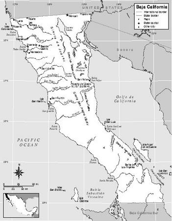
1 Location and Size
Baja California lies on the Baja California peninsula, a long finger of land in western Mexico extending south from the US state of California. The state of Baja California covers the northern part of the peninsula and has an area of 71,576 square kilometers (27,635 square miles). It is slightly larger in area than the US state of West Virginia. Its north-south length is similar to the state of Florida. Baja California is bordered on the north by California, on the west by the Pacific Ocean, on the east by the Golfo de California and the Colorado River, and on the south by Baja California Sur. Baja California is divided into 5 municipalities. The capital, Mexicali, is
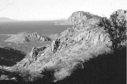
South of Loreto, the Sierra de la Giganta.
The peninsula is covered with mountains (sierras), with broad valleys lying between the mountain peaks. The larger cities and towns, including Mexicali, Las Palmas, Tijuana, Guadalupe, and Real de Castillo, lie in valleys.
Water runs down the slopes of the mountain ranges into the Pacific Ocean and the Sea of Cortés, which is part of the Golfo de California. Due to its geological formation and to long-lasting droughts, the state of Baja California has no large rivers. Springs are scarce and offer little water.
There are 35 islands, most of them lying in the Golfo de California. A few islands lie close to the west coast. Guadalupe Island lies 94 kilometers (150 miles) west of Baja California in the Pacific Ocean.
2 Climate
The climate is dry, with annual rainfall averaging 30 to 60 centimeters (12 to 24 inches). Fog and winter rains are typical in the coastal area around Tijuana near the border with the United States. In the northeast and the south, the climate has wide temperature differences between the hot days and the very cold nights. The center of the state is cooler, with cold
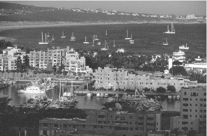
Cabo San Lucas harbor and marina.
3 Plants and Animals
Tourists enjoy watching gray whales give birth in the protected waters along the coast. Many species of ducks and other marine birds find habitat in the coastal areas.
In the mountains, there are coyotes, white-tailed deer, puma, lynx, wild sheep, and many species of snakes. Species of eagles and red-tailed hawk soar above the mountain peaks.
Plants of the state may be categorized by their environments: salt marshes; coastal dunes; chaparral scrub; and forest, which is found in the mountains. Of a total of 450 important plant species in Mexico, 211 (47%) are found in Baja California. Jojoba and palmilla (also called soaptree yucca) are both widespread because they tolerate dry growing conditions. Jojoba seeds have many commercial uses, such as in lubricants, cosmetics, and medicines. The mountainous regions have alpine plants and pine forests. Coastal areas have various low-growing shrubs and cactus.
4 Environmental Protection
The government is concerned about improving air and water quality. Management of hazardous waste is also a concern. Water quality is a particular concern in the Colorado River basin, where untreated sewage and power plant waste are a problem.
5 Population, Ethnic Groups, Languages
Baja California had a total population of 2,487,367 in 2000; of the total, 1,252,581 (just over 50%) were men and 1,234,786 (just under 50%) were women. The population density was 35 people per square kilometer (91 people per square mile). In 2000, the capital of Mexicali had 764,902 residents. As of 2000, almost all residents speak Spanish as their first language; about 2% of the citizens of Baja California speak one of the Amerindian languages.
Since the 1980s, hundreds of thousand of people have migrated from the states of southern Mexico to find work in Baja California. Many hope to eventually cross the border into the United States.
6 Religions
According to the 2000 census, 66% of the population, or 1.6 million people, were Roman Catholic; 6%, or 158,874 people, were Protestant. That year there were also 6,653 Seventh-Day Adventists, 6,334 Mormons, 41,472 Jehovah's Witnesses, and nearly 155,000 people who reported no religion.
7 Transportation
Baja California has about 11,000 kilometers (7,000 miles) of roadways. Four-lane highways connecting the 4 main cities make up just over 500 kilometers (200 miles).
Four international airports—Tijuana, Mexicali, San Felipe, and Enseñada—provide commercial air service.
8 History
Before the first Spaniards reached the region in 1533, different groups of hunters and gatherers occupied Baja California. The Yumano and Cucapás civilizations reached a considerable level of religious and artistic development prior to 1533.
Spaniard Hernán Cortés (1485–1547) led two expeditions to Baja California in 1535 and 1536. He wanted to conquer what he believed was an island. In 1602, Sebastián Vizcaíno (c. 1550–1616) led an expedition that renamed the old Santa Cruz port with its modern name, La Paz. Although there were some efforts to establish a Spanish colony in the 1600s, the first permanent nonindigenous settlement was a Jesuit (an order of the Roman Catholic Church) mission created in 1697.
Jesuit priests introduced new crops and helped the natives with agricultural techniques. The Spaniards enslaved the native people and brought diseases from home. These two factors combined to decimate (greatly reduce) the native population throughout the 1700s.
The Jesuits were expelled from Mexico in 1767 by a decree issued by the Spanish crown. This allowed Franciscan monks (from another order of the Roman Catholic Church) the freedom to move in to populate Baja California. Together with Alta California (now the US state of California), Baja California was made a Spanish province in the mid-1700s. It then officially merged with Alta California to create a territory of the Spanish viceroyalty (territory ruled by Spain) of Mexico.
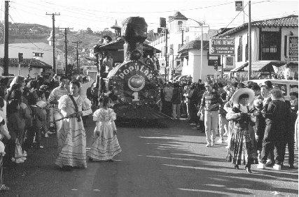
Carnival the week before the Christian holiday, Ash Wednesday, in Ensenada.
In 1804, Baja and Alta California were divided again into two separate provinces. Because of their physical isolation, the people living in Baja California did not join in the drive for independence in 1810. Governor Fernando de la Toba declared Baja California's independence in 1822. A constitution was created in 1824. Baja California and Alta California were once again merged into a Mexican province, with San Diego as its capital and José María de Echandía as governor.
In 1829, the provincial capital was moved to La Paz, which is the modern-day capital of the state of Baja California Sur.
During the Mexican-American War (1846–48), Baja California was disputed territory. Mexican patriots fought against US soldiers. In the Treaty of Guadalupe Hidalgo in 1848, Mexico ceded Alta California to the United States, and it became the state of California. Mexico kept Baja California. Conflicts over control of Baja California persisted. American pirate William Walker attacked Baja California in 1853 and occupied La Paz and Cabo San Lucas. He declared independence and claimed to be president of the new republic. He was later expelled and deported to the United States.
From 1876 to 1910, Baja California witnessed widespread persecution of native indigenous groups. Lands of the native people were taken by the government for agricultural use in the name of Mexican progress and development. The International Company of Mexico, a Connecticut-based corporation, was granted almost half of the territory for different economic initiatives starting in 1886.
The Mexican Revolution took place from 1910 to 1920. Revolution sympathizers attacked Mexicali in 1911. Political instability in the rest of Mexico led many on both sides of the California border to push for the annexation of Baja California to the United States. Some activists in the United States promoted a movement for Baja California to secede (break away) from Mexico. Opposition from Mexican patriots who wanted to keep Baja California as part of Mexico prevented this from happening.
After the Mexican Revolution, a new constitution established the country of Mexico, but the government was not stable. The new Mexican government took control of Baja California and discouraged the idea that Baja California join the United States. Baja California was a territory of Mexico for the next 35 years.
Baja California was restructured into the Baja California Norte (North) and Baja California Sur (South) territories in 1952. The central Mexican government appointed governors in Baja California Norte and Baja California Sur, solidifying the division of the peninsula into two different provinces.
In 1952, Baja California became Mexico's 29th state, while Baja California Sur remained a territory. Braulio Maldonado Sandez, a member of the Institutional Revolutionary Party (PRI), became the first state governor under the new constitution.
9 State and Local Government
Baja California became Mexico's 29th state officially on December 31, 1952. Its constitution was accepted in 1953. Braulio Maldonado Sandez, a member of the Institutional Revolutionary Party (PRI), became the first state governor under the new constitution. In 2001, Eugenio Elorduy Walther of the National Action Party (PAN) won the election to become the 12th governor. His 6-year nonrenewable term will expire in 2008. A unicameral (single chamber) legislature is comprised of a 25-member Chamber of Deputies. The deputies are elected for a nonrenewable 3-year term. Sixteen of the deputies are elected from single-member districts and 9 are elected at large.
The governments of Baja California's 5 municipalities enjoy limited autonomy (self-government). The municipal president is elected to a nonrenewable 3-year term. The president governs with a local municipal council. The state legislature has the power to intervene in municipal government under certain circumstances. By controlling budget allocation, the state government exerts immense influence over local authorities.
10 Political Parties
The 3 main political parties in all of Mexico are the Institutional Revolutionary Party (PRI), the National Action Party (PAN), and the Party of the Democratic Revolution (PRD). As in the rest of Mexico, the PRI was the most powerful and influential party in Baja California until the late 1980s, controlling the state and most municipal governments. In 1989, PAN leader Ernesto Ruffo became the first non-PRI state governor. In 1995, Hector Terán won the state for the PAN again. Eugenio Elorduy Walther obtained a third consecutive PAN victory in 2001.
11 Judicial System
The Supreme Tribunal of Justice is comprised of 13 justices elected for nonrenewable 6-year terms. The Supreme Tribunal president is elected by the 13 justices for a nonrenewable 2-year term. Justices are appointed by a two-thirds majority in the legislature from among a list of nominees presented by the Supreme Tribunal. Only qualified lawyers can be appointed to the Supreme Tribunal. In addition, there is a tribunal of electoral justice comprised of 3 members elected for 3-year terms. Local tribunals complete the state judicial system.
12 Economy
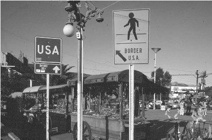
Agriculture, maquiladora (manufacturing assembly plants), tourism, and mining are important parts of the economy. Baja California has 6 highway border crossing points into the US state of California. In 2000, approximately 180,000 cars crossed the border each day. The busiest border crossing is between Tijuana, Baja California, and San Ysidro, California. About 50,000 cars cross the border there each day, with 25,000 people crossing on foot. The Port of Enseñada is located on the Pacific Ocean and provides services for international trade.
13 Industry
Baja California has many industrial parks. In Tijuana and Mexicali, there are dozens of industrial parks devoted to auto parts and electronics manufacturing.
14 Labor
The United States Bureau of Labor Statistics reported that Mexican workers saw their wages increase 17%, from $2.09 per hour in 1999 to $2.46 per hour in 2000. (By comparison, the average American worker earned $19.86 per hour in 2000.) After one year, workers are entitled by law to six days paid vacation.
Amerindian migrant agricultural workers, primarily of Mixtec and Zapotec descent, have been discriminated against throughout the state's history. As of 2004, migrant workers were attempting to organize, through the Independent Confederation of Farm Workers and Peasants (CIOAC), to demand better treatment by their employers and the government.
15 Agriculture
Agriculture is important to the state economy. Most agriculture is done in the region around Mexicali. The main products are wheat, tomato, broccoli, alfalfa, cotton, sorghum, and garlic. Other crops include grapes, dates, carob, lemons, and oranges. Agricultural crops grown for export to the United States, Canada, Europe, and Asia are chives, radishes, asparagus, melons, celery, lettuce, onions, and watermelon.
16 Natural Resources
Fishing in the coastal waters off Baja California is an important economic activity. Principal fish caught include sole, tuna, sardines, mackerel, and lobster. The extraction of salt from ocean saltwater is
Tijuana lies on the border with the US state of California.
17 Energy and Power
Electricity is generated by 10 power plants, with a total capacity of 2,285 megawatts. Four of these are geothermal (using heat from the earth's interior), representing 720 megawatts. Baja California generates enough electricity to satisfy the state's needs and to export energy to neighboring Sonora and to the United States.
Mexicali has natural gas resources; as of 2004 a pipeline between Mexicali and Tijuana with the capacity to carry 14 million cubic meters (500 million cubic feet) of natural gas per day was under construction.
18 Health
The state of Baja California has 20 general hospitals, 220 outpatient centers, and 67 surgical centers.
Most of the Mexican population is covered under a government health plan. The IMSS (Instituto Mexicano de Seguro Social) covers the general population. The ISSSTE (Instituto de Seguridad y Servicios Sociales de Trabajadores del Estado) covers state workers.
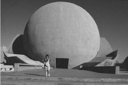
The Tijuana Cultural Center.
19 Housing
In 2000, there are an average of 4.2 people per household. About 95% of the houses in the state have electricity, 77% have sewer connections, and 87% have running water. Some 73% of the houses are owner-occupied, and 27% are occupied by renters.
The influx of hundreds of thousands of people who have moved from the southern states of Mexico north toward the US border has produced a severe shortage of land and housing.
20 Education
President Benito Juárez (1806–1872) launched the system of public education in 1867. Public education in Mexico is free for students ages 6 to 16, but most who can afford it go to private schools. This has created a gap in education between the social classes. The population of school-age children (3–19) was 452,173 in 2000.
Students may enroll in Universidad Autónoma de Aguascalientes (Autonomous University of Aguascalientes) or the Instituto Tecnológico de Aguascalientes (Technical Institute of Aguascalientes).
21 Arts
The state of Baja California sponsors many dance groups including the Balleto Folklórico de Ticuan, a jazz ensemble (Dat'Z Jazz), Groupo Almalafa, and Groupo Mal Paso. Baja California also has a professional orchestra. The city of Enseñada is home to the Galería de Perez Meillon, which showcases native crafts such as the traditional willow baskets of the Pai-Pai Indians.
22 Libraries and Museums
There are 44 branches of the national library in the state of Baja California.
Among the 20 museums of Baja California are several history museums in Enseñada and a wax museum and a pre-Columbian museum in Tijuana.
23 Media
The capital city, Mexicali, has two papers: La Crónica de Baja California and La Voz de la Frontera. Tijuana has three papers: El Sol de Tijuana, La Frontera, and Zeta.
24 Tourism, Travel, and Recreation
Outdoor water sports such as deep sea fishing, scuba diving, and snorkeling provide vacationers with reasons to visit Baja California. Rosarito Beach, Enseñada, and Mexicali are easy access points from San Diego, California. There is tourist shopping in the border town of Tijuana.
The state capital of Mexicali offers many tourist attractions. The Plaza Calafia offers tourists a look at real bullfighting. The city park has a zoo and local marketplace. In October, Mexicali hosts its annual fair, the Fiesta del Sol. There are beautiful beaches at San Felipe on the Sea of Cortés.
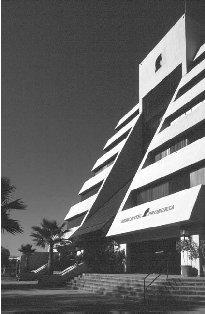
Modern building in Tijuana.
25 Sports
Mexicali's baseball team, the Aguilas, plays in the Nido Aguilas (Eagle's Nest) Mexicali stadium, seating 12,000 people. Los Mochis's baseball team, the Cañeros, plays in the Emilio Ibarra Almada stadium holding 15,000 people.
Major bullfighting venues include the Plaza de Toros in Tijuana, with seating for 21,621. It is part of the large complex, Playas Tijuana, which also has a racetrack. Mexicali's bullfighting ring, Plaza Calafia, seats 10,000.
Tijuana's soccer team plays in the National de Tijuana stadium, where there is seating for 12,000. Tijuana's basketball team, the Tazmania Diablos, plays in the Fausto Gutierrez Moreno stadium, where there is seating for 4,500.
26 Famous People
Fernando de la Toba declared independence in Baja California. Braulio Maldonado Sandez (1903–1990), a member of the PRI (Institutional Revolutionary Party), became the first state governor. Missionary Eusebio Kino (1645–1711) attempted to establish a mission program in Baja California in the 1670s.
27 Bibliography
Books
Supples, Kevin. Mexico. Washington, DC: National Geographic Society, 2002.
Williams, Jack, The Magnificent Peninsula: The Comprehensive Guidebook to Mexico's Baja California. Redding, CA: H. J. Williams, 2001.
Web Sites
Government of Baja California, English-language version. http://www.bajacalifornia.gob.mx/english/home.htm (accessed on June 11, 2004).
Mexico for Kids. http://www.elbalero.gob.mx/index_kids.html (accessed on June 11, 2004).
Comment about this article, ask questions, or add new information about this topic: