United States - Location, size, and extent
Located in the Western Hemisphere on the continent of North America, the United States is the fourth-largest country in the world. Its total area, including Alaska and Hawaii, is 9,629,091 sq km (3,717,813 sq mi). The conterminous United States extends 4,662 km (2,897 mi) ENE — WSW and 4,583 km (2,848 mi) SSE – NNW . It is bordered on the N by Canada, on the E by the Atlantic Ocean, on the S by the Gulf of Mexico and Mexico, and on the W by the Pacific Ocean, with a total boundary length of 17,563 km (10,913 mi). Alaska, the 49th state, extends 3,639 km (2,261 mi) E – W and 2,185 km (1,358 mi) N – S . It is bounded on the N by the Arctic Ocean and Beaufort Sea, on the E by Canada, on the S by the Gulf of Alaska, Pacific Ocean and Bering Sea, and on the W by the Bering Sea, Bering Strait, Chukchi Sea, and Arctic Ocean, with a total land boundary of 12,034 km (7,593 mi) and a coastline of 19,924 km (12,380 mi). The 50th state, Hawaii, consists of islands in the Pacific Ocean extending 2,536 km (1,576 mi) N – S and 2,293 km (1,425 mi) E – W , with a general coastline of 1,207 km (750 mi).
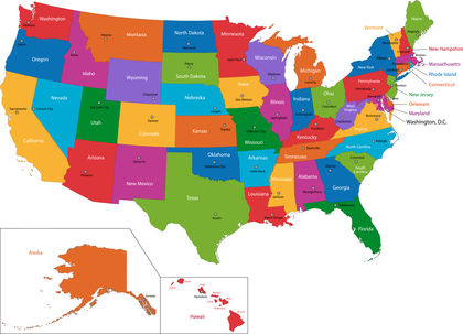
The nation's capital, Washington, D.C., is located on the mid-Atlantic coast.
project.