The Bahamas - Transportation
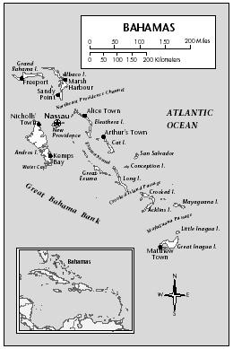
The larger islands have modern road networks. In 2002 there were about 2,693 km (1,673 mi) of highways, of which 1,546 km (961 mi) were paved. There were 80,000 passenger cars and 24,283 commercial vehicles in 2000. About 60% of all vehicles are on New Providence. There are no railways.
The Bahamas established a shipping register in 1976. In 2002, this archipelago nation had a merchant fleet of 1,076 ships of 1,000 GRT or over, with a total volume capacity of 31,309,9187 GRT and a deadweight capacity of 45,859,485 tons. Nassau is a major port of call for cruise ships, which visit Freeport as well. Airports in 2001 totaled 67, of which 30 had paved runways. There are international airports at Nassau and Freeport, with frequent connections to the United States, Canada, and the

United Kingdom. In 2001, 1,625,700 passengers were carried on scheduled domestic and international airline flights. Bahamas Air, a state-owned enterprise, is the national airline.