MALI
Republic of Mali
République du Mali
COUNTRY OVERVIEW
LOCATION AND SIZE.
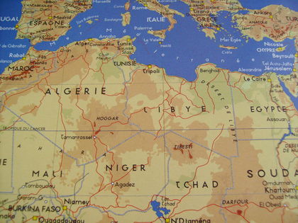
Mali is a landlocked country in West Africa covering an area of 1.24 million square kilometers (478,764 square miles), of which 1.22 million square kilometers (471,042 square miles) is occupied by land and 20,000 square kilometers (7,722 square miles) is occupied by water. Its border is 7,243 kilometers (4,500 miles) long. Of this, 1,376 kilometers (855 miles) in the northeast is shared with Algeria; 2,237 kilometers (1,390 miles) with Mauritania in the northwest; 419 kilometers (260 miles) with Senegal in the west; 858 kilometers (533 miles) with Guinea in the southwest; 532 kilometers (330 miles) with Côte d'Ivoire in the south, 1,000 kilometers (621 miles) in the south by Burkina Faso; and 821 kilometers (510 miles) in the southeast by Niger. The lowest point is at the Senegal river which lies 23 meters (75 feet) above sea level, while the highest point is at Hombori Tondo standing at 1,155 meters (3,789 feet) above sea level.
The northern half of Mali consists of desert, while the southern half is rain-fed land where most agriculture is undertaken without irrigation. Between these 2 areas lies the Sahel zone, where cultivation depends largely on the flooding of the river Niger which flows through the heart of the country, providing a vital waterway and source of fish. As the seasonal floods retreat, they leave behind pasture, on which thousands of livestock depend, desperate for food and water after a dry season lasting 8 months, as well as land for cultivation in an otherwise arid environment.
POPULATION.
July 2000 estimates reported the population at 10.69 million, up from the April 1998 census figure of 9.79 million. The current rate of population growth is estimated at 3 percent per year, and this is particularly high, implying a fertility rate of 6.9 children per woman. Mali has a young population with only 3 percent estimated in 2000 to have been over 65 years while the 47 percent and 50 percent were under 15 years and between 15 and 65 years, respectively. Only 26 percent of the population lived in towns in 1998.
The main ethnic group is the Bambara, while minority groups include Songhai, Mandinka, Senoufo, Dogon, and Fula. The north is populated mainly by the nomadic Tuareg. By composition, the Mande (who include Bambara, Malinke, and Soninke) comprises 50 percent of the population, Peul 17 percent, Voltaic 12 percent, Songhai 6 percent, Tuareg and Moor 10 percent and others 5 percent. About 90 percent of the population are Muslim, 1 percent Christian and 9 percent follow traditional beliefs. French is the official language, although Bambara is spoken by 80 percent of the population.
DEPENDENCIES
Mali has no territories or colonies.
BIBLIOGRAPHY
Economist Intelligence Unit. Country Profile: Mali. London: EIU, 2000.
"Mali." Africa South of the Sahara. London: Europa Publications, 2000.
Hodd, M. "Mali." The Economies of Africa. Aldershot:Dartmouth, 1991.
U.S. Central Intelligence Agency. World Factbook 2000: Mali. <http://www.cia.gov/cia/publications/factbook/geos/ml.html> . Accessed September 2001.
World Bank. World Bank Africa Database 2000. Washington DC: World Bank, 2000.
—Allan C. K. Mukungu
CAPITAL:
Bamako.
MONETARY UNIT:
Communauté Financiére Africaine Franc (CFA Fr). CFA Fr1 equals 100 centimes. Notes include denominations of 500, 1,000, 2,500, and 10,000. Coins include 1, 5, 10, 25, 100, 250, and 500 denominations.
CHIEF EXPORTS:
Cotton, livestock, gold, hides and leather, shea-nuts, fish.
CHIEF IMPORTS:
Heavy machinery, transport equipment, construction materials, petroleum, foodstuffs, textiles, chemical products, consumer manufactured goods.
GROSS DOMESTIC PRODUCT:
US$8.5 billion (purchasing power parity, 1999 est.).
BALANCE OF TRADE:
Exports: US$640 million (f.o.b., 1999 est.). Imports: US$650 million (f.o.b., 1999 est.).
Comment about this article, ask questions, or add new information about this topic: